Tropical Cyclone Trevor

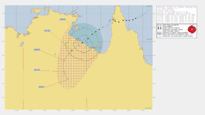
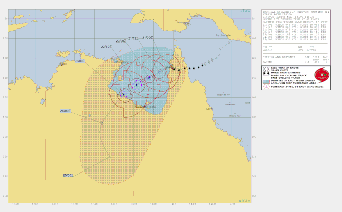
Tropical Cyclone Trevor made landfall on the far North East Queensland coast on 19 March 2019 as a Category 3 Severe Tropical Cyclone and crossed Cape York Peninsular. Trevor moved South West across the Gulf of Carpentaria while developing from a category 1 to a category 4 Severe Tropical Cyclone and made landfall on the South East coast of the Gulf of Carpentaria in NT on Saturday (23 March 2019) at around 10 am.
Details of Severe Tropical Cyclone Trevor at 4:36 am ACST [5:06 am AEST] on Saturday 23 March 2019
The very destructive core of Severe Tropical Cyclone Trevor is approaching the coast between Port McArthur and the NT/Qld border.
Areas Affected:
Warning Zone
Alyangula in the Northern Territory to Burketown in Queensland, and inland parts of the Carpentaria District, Barkly District and the northwest Gulf Country, including Groote Eylandt, Mornington Island, Borroloola, Robinson River, Wollogorang, McArthur River, Cape Crawford, Creswell Downs, Brunette Downs and Doomadgee.
Intensity: Category 4, sustained winds near the centre of 175 kilometres per hour with wind gusts to 250 kilometres per hour.
Location: within 20 kilometres of 15.5 degrees South 138.2 degrees East, estimated to be 165 kilometres northwest of Mornington Is and 215 kilometres east northeast of Borroloola.
Movement: southwest at 16 kilometres per hour.
Severe Tropical Cyclone Trevor is now a category 4 system. The very destructive core is expected to cross the Northern Territory coast on Saturday morning.
Hazards:
The VERY DESTRUCTIVE core of Severe Tropical Cyclone Trevor is forecast to cross the southern coast of the Gulf of Carpentaria between Port McArthur and the NT/Queensland Border Saturday morning with VERY DESTRUCTIVE WINDS, with gusts to 275 km/h near the cyclone centre as it approaches and crosses the coast.
Coastal residents between Port Roper and the NT/Queensland Border are specifically warned of a VERY DANGEROUS STORM TIDE as the cyclone centre approaches the coast. Tides will rise significantly above the normal high tide, with DAMAGING WAVES and VERY DANGEROUS FLOODING during Friday night and Saturday.
As the cyclone approaches the coast, a STORM TIDE is also expected between the NT/QLD border and Burketown. Large waves may produce minor flooding along the foreshore. People living in areas likely to be affected by this flooding should take measures to protect their property as much as possible and be prepared to help their neighbours.
GALES, with gusts to 120 km/h are occurring on Mornington Island, Sweers Island and on the mainland coast between Port McArthur in the Northern Territory and Burketown in Queensland. Gales are also expected to extend to Groote Eylandt before dawn as the system approaches the coast and extend east to Ngukurr during the day.
GALES are expected to extend inland into the eastern Carpentaria and northern Barkly Districts and the northwest Gulf Country this morning. Inland locations which may be affected on Saturday and early Sunday include Doomadgee, Creswell Downs, Cape Crawford, Robinson River, McArthur River, Wollogorang and Brunette Downs.
HEAVY RAINFALL is likely to cause significant stream rises and localised flooding in the eastern Carpentaria District from early Saturday. A Flood Watch has been issued for Carpentaria Coastal Rivers and the Barkly in the Northern Territory.
HEAVY RAINFALL will also develop over the western Gulf Country in Queensland as the cyclone moves inland. Flood Warnings are current in Queensland for the Daintree and Mossman Rivers, as well as a broader Flood Watch for catchments north of Cairns to Kowanyama, the western Gulf Country, and the Channel Country.

Tropical Cyclone Trevor has generated extreme wave conditions at Weipa on the North coast of the Gulf of Carpentaria.

Tropical Cyclone Trevor has generated a storm surge at Burketown and Mornington Island on the South coast of the Gulf of Carpentaria. 7:31am 23 March 2019.


