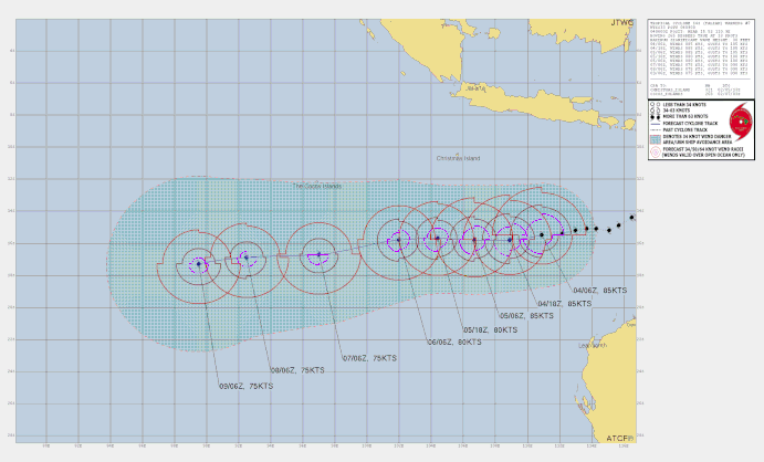
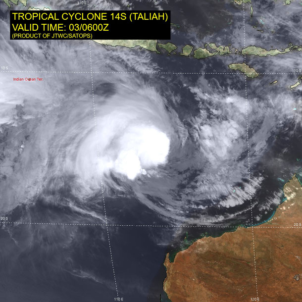
Tropical Cyclone Taliah
Tropical cyclone (TC) Taliah developed off the Weatern Australian coast north of Karratha on February 2 2025. TC Tahlia moved towards the west-southwest while developing to a category 4 severe tropical cyclone on February 4 2025. Tahlia did not impact the Australian Mainland. Teliah continued to move westward before detioriating on February 12 2025.

TROPICAL CYCLONE INFORMATION BULLETIN
Issued at 2:49 pm AWST on Tuesday 4 February 2025
Severe Tropical Cyclone Taliah (Category 3) was located at 2:00 pm AWST near 15.5S 111.0E, that is 790 km north northwest of Exmouth and 800 km southeast of Christmas Island and moving west at 18 kilometres per hour.
Severe Tropical Cyclone Taliah lies well to the northwest of the Pilbara coast and is moving to the west. Taliah is likely to remain a severe tropical cyclone in the coming days. There is high confidence in the track continuing to the west and remaining well away from the Western Australian coast. Severe Tropical Cyclone Taliah will not directly impact the Australian mainland nor any island communities.
From www.bom.gov.au