Tropical low 30U (potential tropical cyclone Fina)
Tropical Low 30U
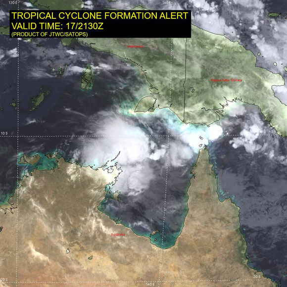
Tropical low (30U) moving into Gulf of Carpentaria with a Moderate chance of being a tropical cyclone this weekend.
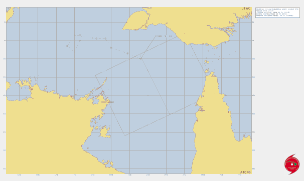
Tropical low 30U is forecast to continue to move to the southeast in the Gulf of Carpentaria through to Saturday then turn to the west on Sunday onwards. It has a Moderate (40%) chance of developing into a tropical cyclone tonight through to Sunday in the Gulf of Carpentaria. From Monday it is forecast to track to the west northwest near the Northern Territory coast and eventually into the Timor Sea. The risk of a tropical cyclone in the longer term is low but this potential will be monitored.
If this system develops to cyclone strength it will be named Fina.
Last updated April 18, 10:57 am AEST

Headline:
Tropical low 30U a Moderate chance of developing into a tropical cyclone in the Gulf of Carpentaria this weekend.
Areas affected:
Warning zone: None.
Watch zone: None.
Cancelled zones: None.
Details of Tropical Low 30U at 9:30 am ACST:
Intensity: tropical low, sustained winds near the centre of 65 kilometres per hour with wind gusts to 95 kilometres per hour.
Location: within 45 kilometres of 11.1 degrees South, 138.9 degrees East , 260 kilometres east northeast of Nhulunbuy and 415 kilometres northeast of Alyangula.
Movement: southeast at 16 kilometres per hour.
Tropical Low 30U is moving southeast in the Gulf of Carpentaria. It has a Moderate chance of developing into a tropical cyclone later today through to Sunday in the Gulf of Carpentaria. It will be slow moving on Saturday before taking a turn to the west on Sunday to approach the Northern Territory coast on Monday.
Gales are forecast south of the centre but not expected to occur on the Queenland Gulf coast.
From www.bom.gov.au