Tropical Cyclone Dianne

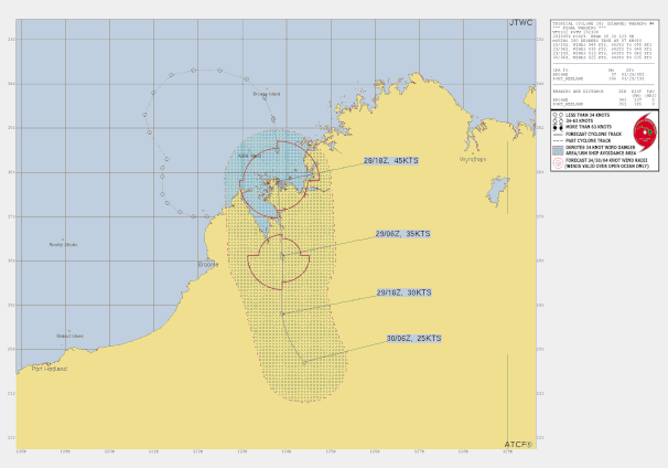
A monsoon trough developed to the north of Western Australia in late March 2025 associated with an active phase of the Madden-Julian Oscillation. Aided by the passage of an Equatorial Rossby Wave, a tropical low formed within the monsoon trough to the northwest of the Kimberley in the early hours of 27 March 2025. The tropical low system moved east towards the Kimberley coast during 27 March. Gales developed initially on the northern side overnight into 28 March and it continued to strengthen quickly as a small system, becoming Tropical Cyclone Dianne that afternoon.
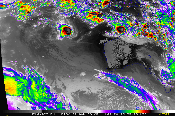
As it strengthened TC Dianne turned south, crossing the coast near Koolan Island as a category 2 tropical cyclone early in the morning of 29 March 2025. Near storm force winds were recorded at Koolan Island as Dianne crossed with a maximum gust of 115 km/h recorded at 2:23am 29 March. Heavy rainfall was also observed through isolated parts of the western Kimberley with Derby Airport recording 153mm in the 24 hours to 9am on 29 March, including 133m in the six hours between 3am and 9am 29 March. Localised flooding was observed throughout Derby and the immediate surrounds. As Dianne moved inland on 30 March it quickly weakened but continued to bring rainfall to inland parts of the Kimberley and Northern Interior.
Tropical Cyclone Dianne was the 10th tropical cyclone in the Australian region for the 2024/25 season.
Extreme values during cyclone event (estimated)
Note that these values may be changed on the receipt of later information
Maximum Category: 2
Maximum sustained wind speed: 95 km/h
Maximum wind gust: 130 km/h
Lowest central pressure: 984 hPa
From www.bom.gov.au