The Fujiwhara effect
What is the Fujiwhara Effect?
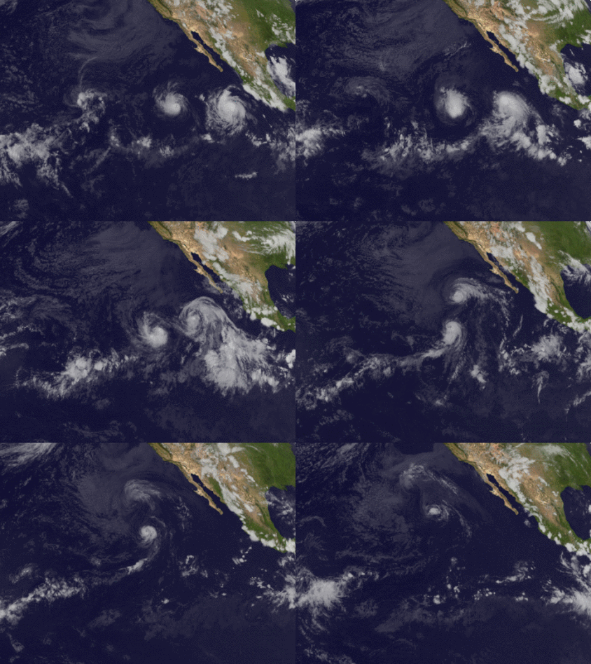
When cyclones are in close proximity of one another, their centers will circle each other cyclonically, counter-clockwise in the Northern Hemisphere and clockwise in the Southern Hemisphere, about a point between the two systems due to their cyclonic wind circulations. The two vortices will be attracted to each other, and eventually spiral into the center point and merge.
It has not been agreed upon whether this is due to the divergent portion of the wind or vorticity advection. When the two vortices are of unequal size, the larger vortex will tend to dominate the interaction, and the smaller vortex will circle around it. The effect is named after Sakuhei Fujiwhara, the Japanese meteorologist who initially described it in a 1921 paper about the motion of vortices in water.
The Fujiwhara effect in Australia
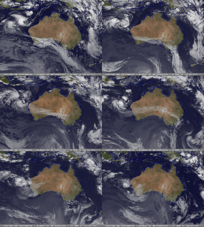
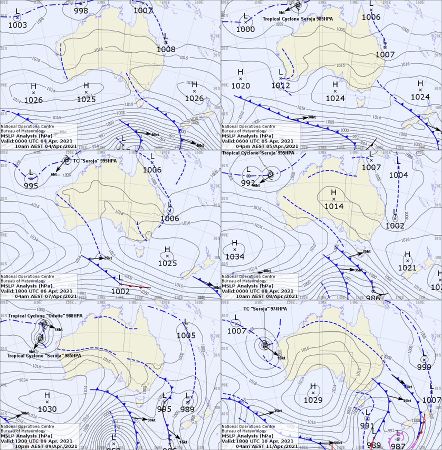
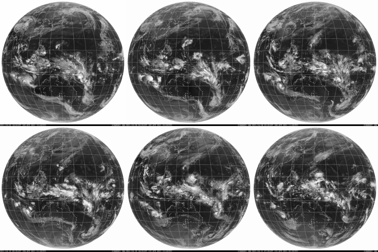
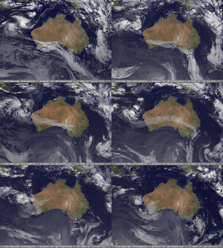
In April 2021 two cyclones had developed off the central Western Australian coast: Tropical Cyclone Seroja and Tropical Cyclone Odette. Tropical Cyclone Seroja formed in the Timor Sea on April 5 2021 and travelled Southwest along the Western Australian coast. On April 9 2021 a second Tropical Cyclone (TC Odette) developed along a low pressure ridge that extended to the West into the Indian Ocean. The presence of TC Odette to the West of TC Seroja forced TC Seroja to change direction towards the Southwest and the two systems rotated together. TC Odette rotated around TC Seroja making almost one full rotation while merging to be one Tropical Cyclone on April 11 2021.
